A few handy data sources
Backdrop maps for Leaflet
leaflet-extras.github.io/leaflet-providers/preview
- You can use huge range of different backdrops
- Transport, terrain, weather, oceans etc
Some notes. They are only visible using onstage shell.
 Leaflet map backdrops
Leaflet map backdrops!
- Pollution, weather, flood
- Defra, MetOffice, NERC, EA
- EA open data such as RoFRS, plus lists selected datasets which may be released in future
- EA open APIs, Live Flood Warnings etc
Some notes. They are only visible using onstage shell.
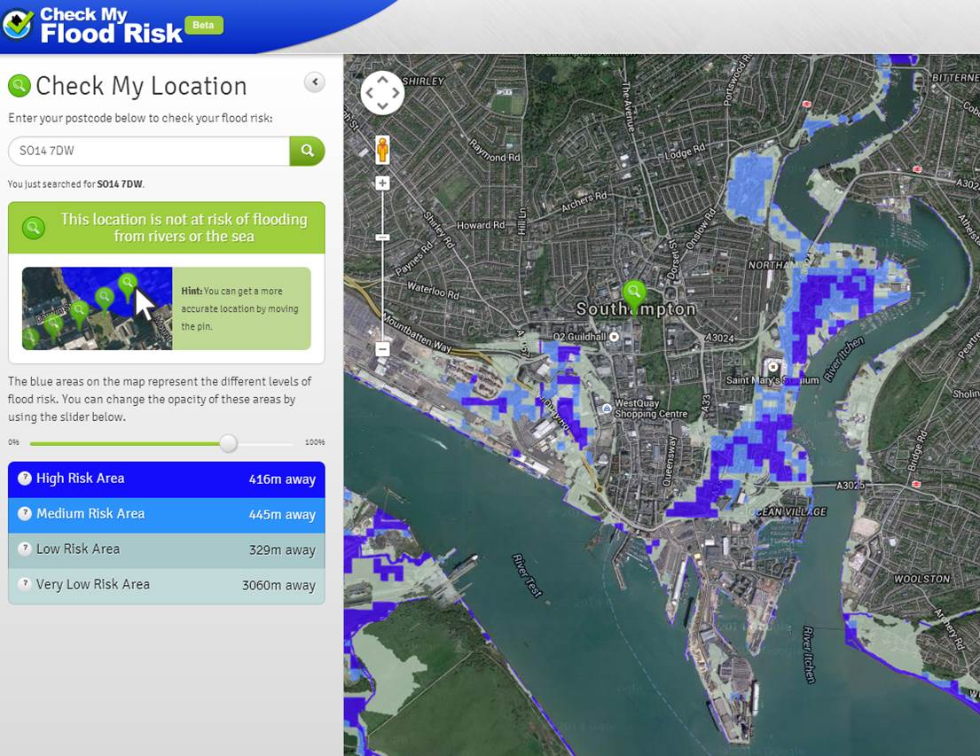 RoFRS data: served by Shoothill.com
EA Flood Warnings example!
You can get Environment Agency Lidar terrain data free for Non-Commercial use!
Request free usage from EA - takes ~24 hours
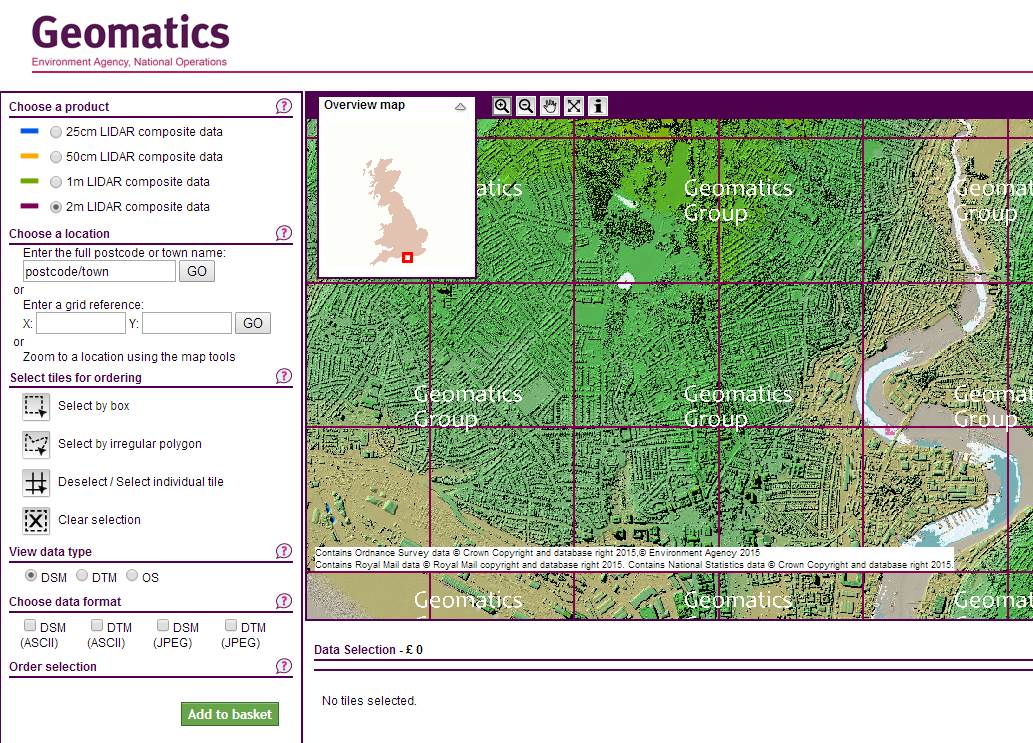
geomatics group webpage!
Public rights of way for England and Wales in KML and GeoJSON.
Not all Local Authorities released data yet.
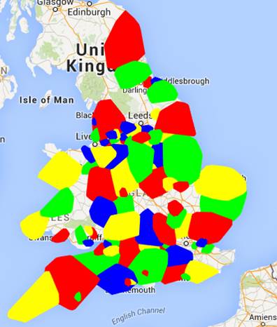
ROW coverage so far!
- Environmental designations - SSSIs, SPAs, SACs, RAMSAR, ancient woodland, habitats, etc
- Natural England
- Natural Resources Wales
Some notes. They are only visible using onstage shell.
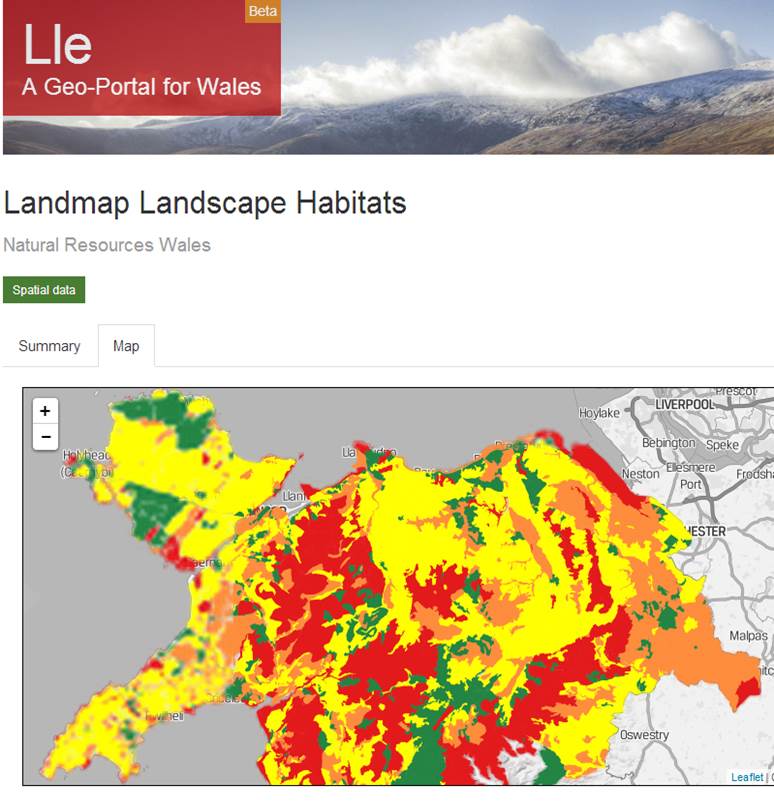
NRW new website!
- Demographic data ready sorted into usable datasets
- housing, wellbeing, deprivation, etc
- .. Plus Greenbelt
Some notes. They are only visible using onstage shell.